
Reading time: 620 words, 3 pages, 2 to 3 minutes.
Until now, there have been no major Atlantic hurricanes this year. However, a tropical storm in the mid-Atlantic intensified into Hurricane Joaquin which gained strength as it approached the Bahamas. Two days ago, it was forecast to become a Category 1 hurricane approaching the U.S. East Coast. You can see an earlier forecast storm-track below.
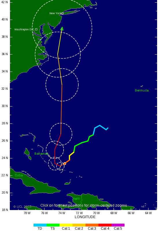
Chart credit: Tropical Storm Risk
Today, the U.S. NOAA National Hurricane Center reported that Joaquin had strengthened to a Category 4 with “maximum sustained winds … increased to near 130 mph (210
km/h) with higher gusts.”
The Weather Channel warns that “Residents along the East Coast of the U.S. should … pay close attention to the forecast now through this weekend. It’s a particularly difficult forecast that hinges on the behavior of several different atmospheric features over North America and the North Atlantic Ocean … Computer forecast models … are grappling with a complex interaction between Joaquin, a cold front near the East Coast, the remnants of Tropical Storm Ida, a strong bubble of high pressure aloft over the North Atlantic Ocean, and a potentially strong area of low pressure aloft digging into the southeastern U.S. later this week.”
Given these complex interactions, it is too soon to accurately forecast landfall on the U.S. East Coast and there is still a chance it could turn and blow out to sea. In any case, parts of the East Coast are already getting hit with rain and wind gusts typical of a frontal system and are likely to continue for a few days.
If you have friends or family living or travelling to the East Coast, please alert them.
Hurricane Joaquin is expected to turn north from the Bahamas Friday and into Saturday. However, “there still remains considerable uncertainty in Joaquin’s future track, and, thus, its potential impact on the U.S. this weekend into early next week.”
The latest Tropical Storm Risk forecast below shows Joachim’s eye bypassing landfall.
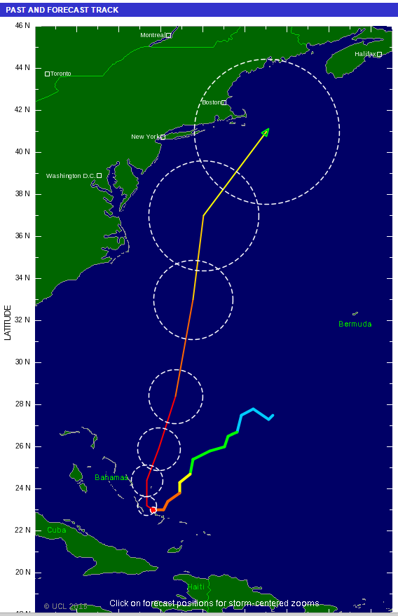
Chart credit: Tropical Storm Risk
We should remember that the 2012 Superstorm Sandy that caused such extensive damage was also influenced by complex weather interactions. Sandy turned sharply inland at the last moment despite prevailing winds that normally push storms offshore.
Will this become another devastating hurricane like Superstorm Sandy? That also is too soon to predict, but there are some differences. Sandy had a much larger wind field diameter of 1,000 miles compared to Joaquin’s present 230 mile diameter. However, that too could change over the next several days.
On the other hand, Weather.com forecasts that Joaquin “… appears poised to dump more widespread, torrential rainfall over a much larger area and population than Sandy did.” Be aware that this will likely happen whether Joaquin reaches landfall or not. They also forecast that Joaquin “is likely to lead to significant coastal flooding, beach erosion and dangerous surf, lasting for several days in some areas. This is the last thing those along the storm-weary stretch of the Outer Banks of North Carolina, Virginia Tidewater, Delmarva Peninsula and Jersey shore want to see following the past weekend’s high surf, coastal flooding and beach erosion event.”
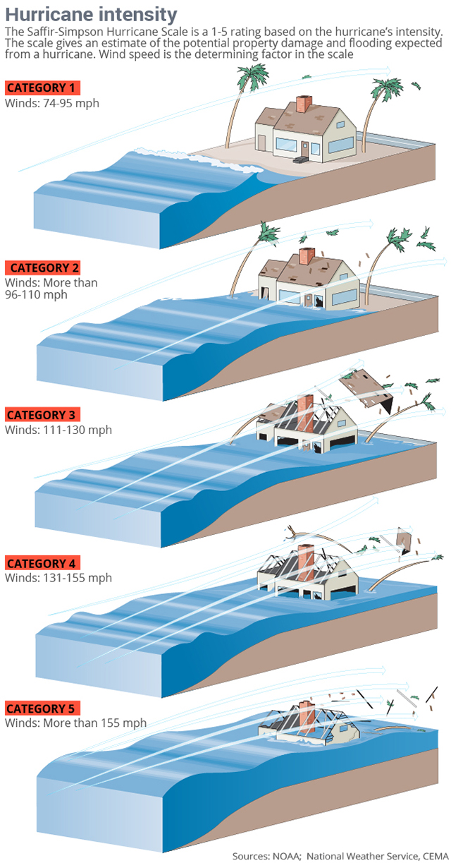
Hurricane intensity by Categories 1 to 5 are shown below.
Parts of Canada will likely also be impacted. Global News reports that the Canadian Hurricane Centre “is keeping a close eye on Joaquin after New Brunswick experienced heavy rains on Wednesday. The system brought the same heavy rain to Nova Scotia on Thursday.” They should have a better forecast by Saturday.
Gerold
October 1, 2015
Your comments are welcome!
If you like what you’ve read (or not) please “Rate This” below.
